2025.09 - 2026.06, The Hong Kong University of Science and Technology (Guangzhou), Research Assistant
2021.09 - 2025.06, Beijing Forestry University, BSc
I am Xiaoyu Li, a young student focused on ecological remote sensing, UAV remote sensing, land-use classification, landscape ecology, and the assessment of human settlement quality.
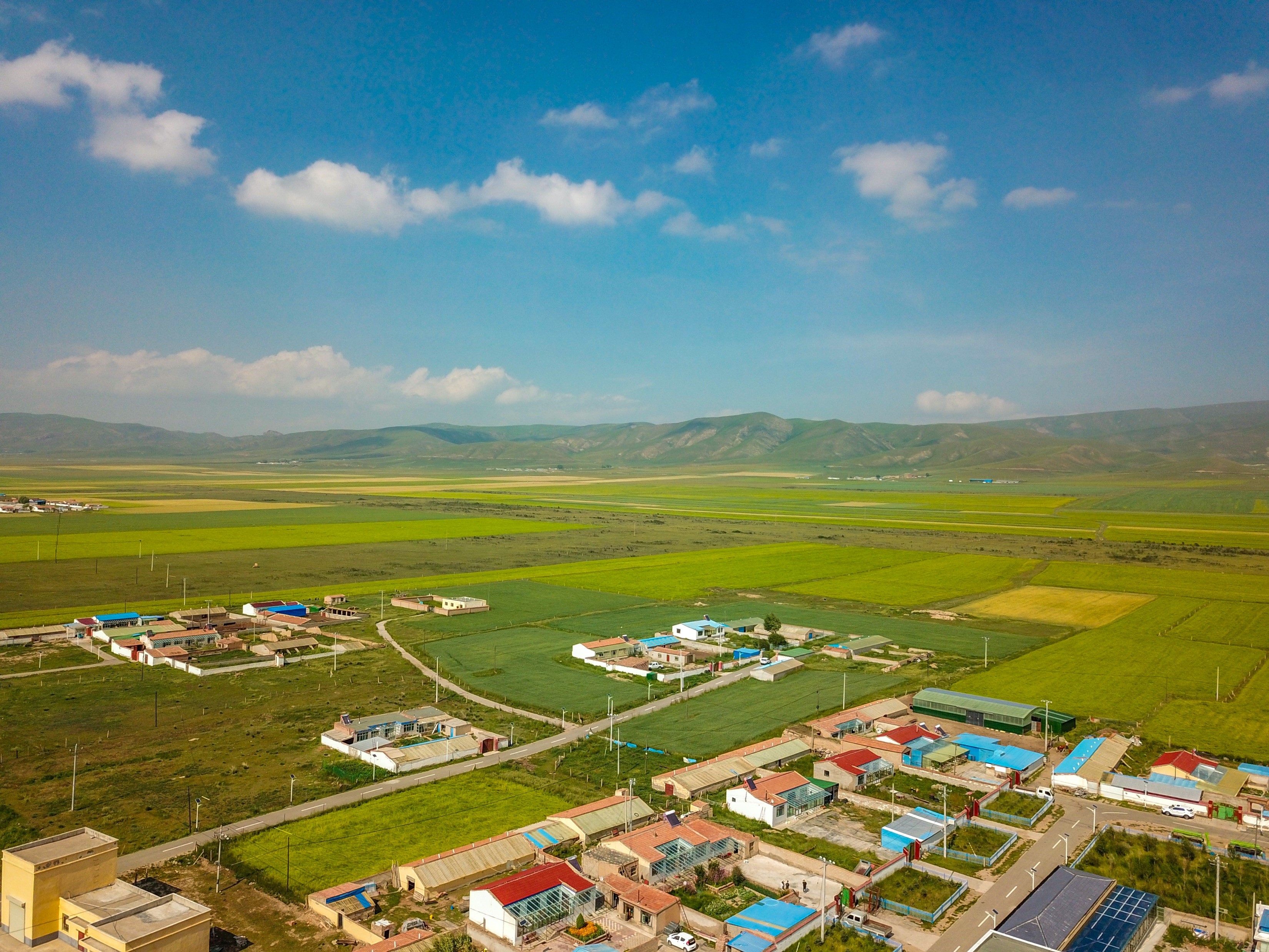
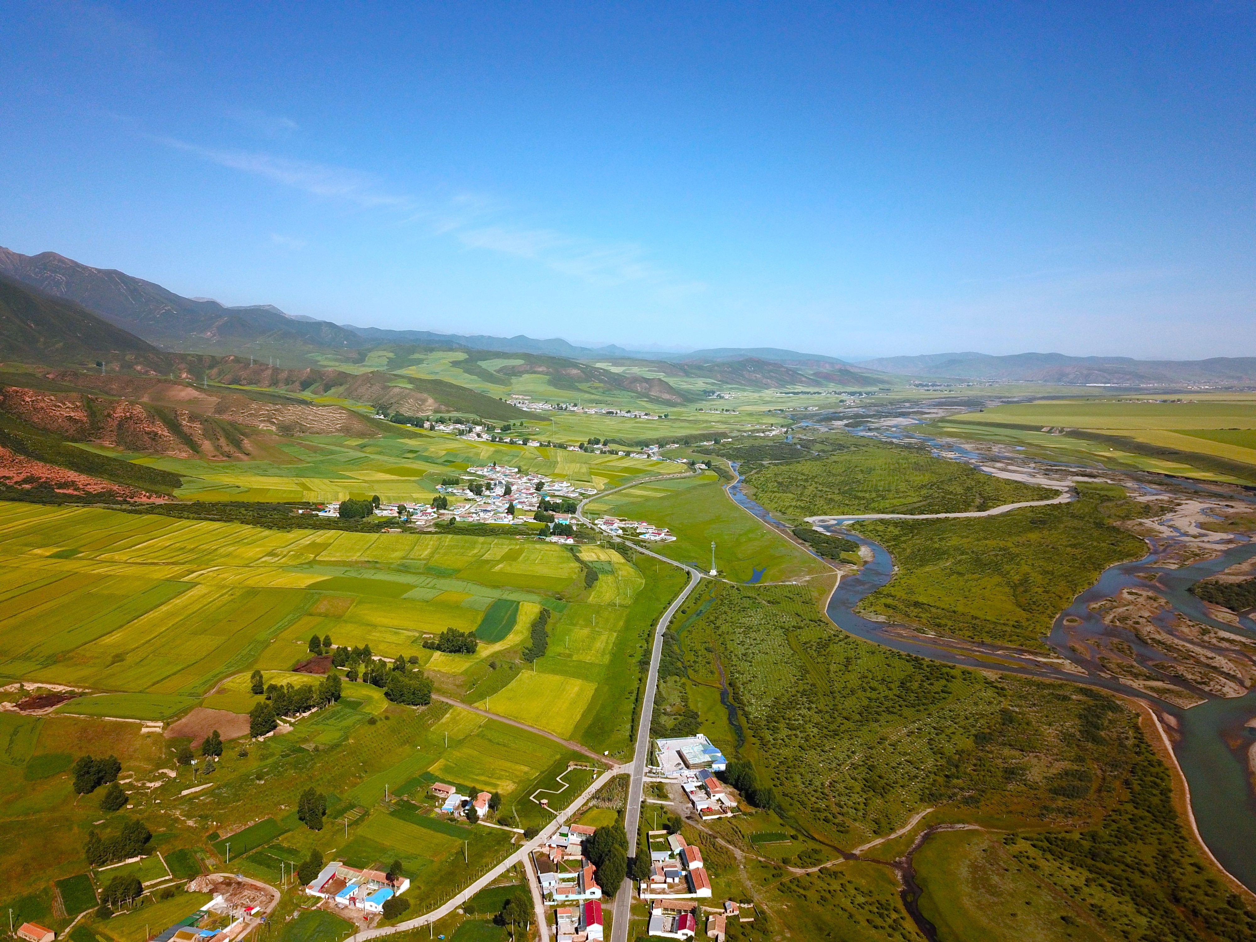
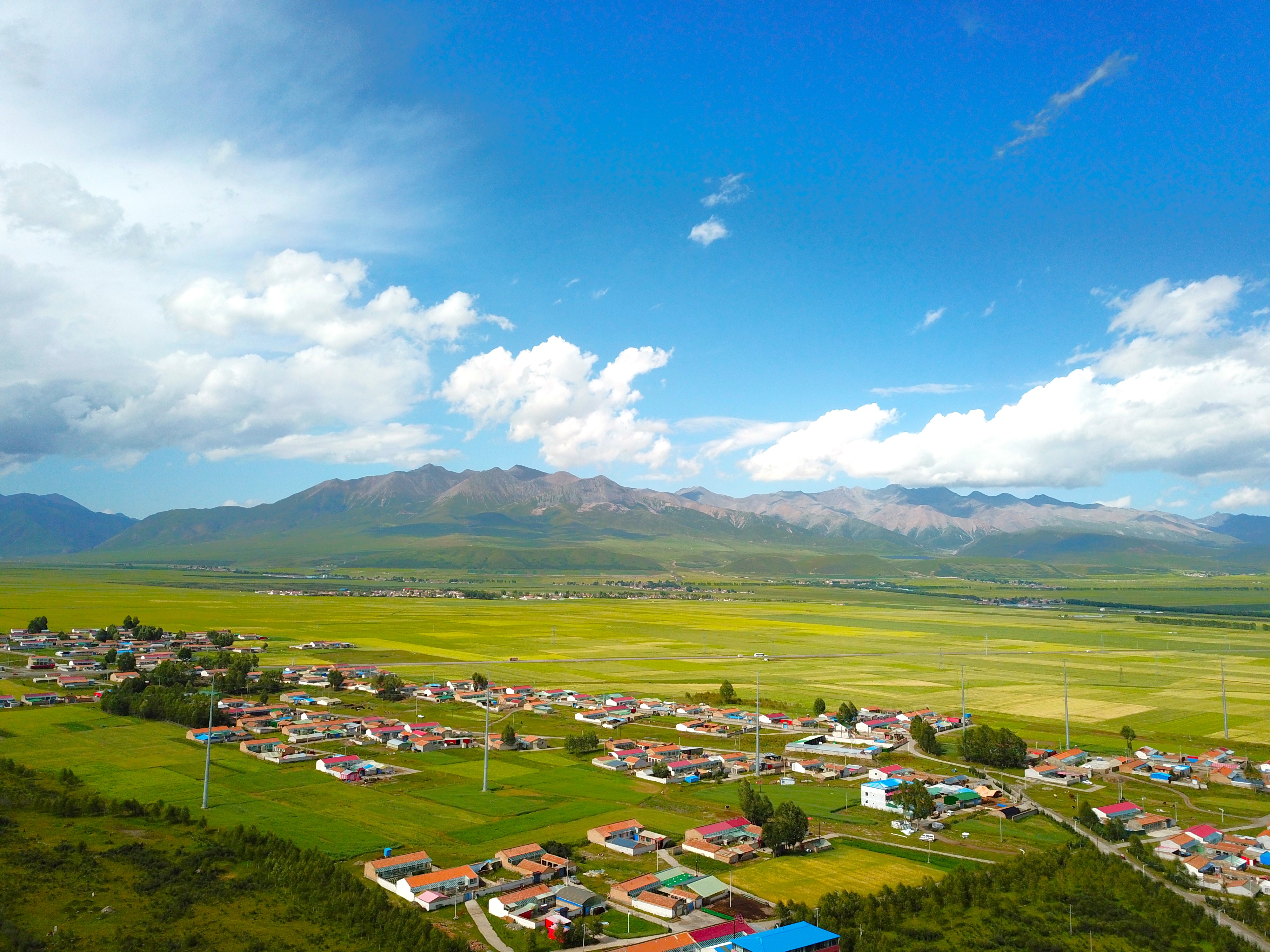
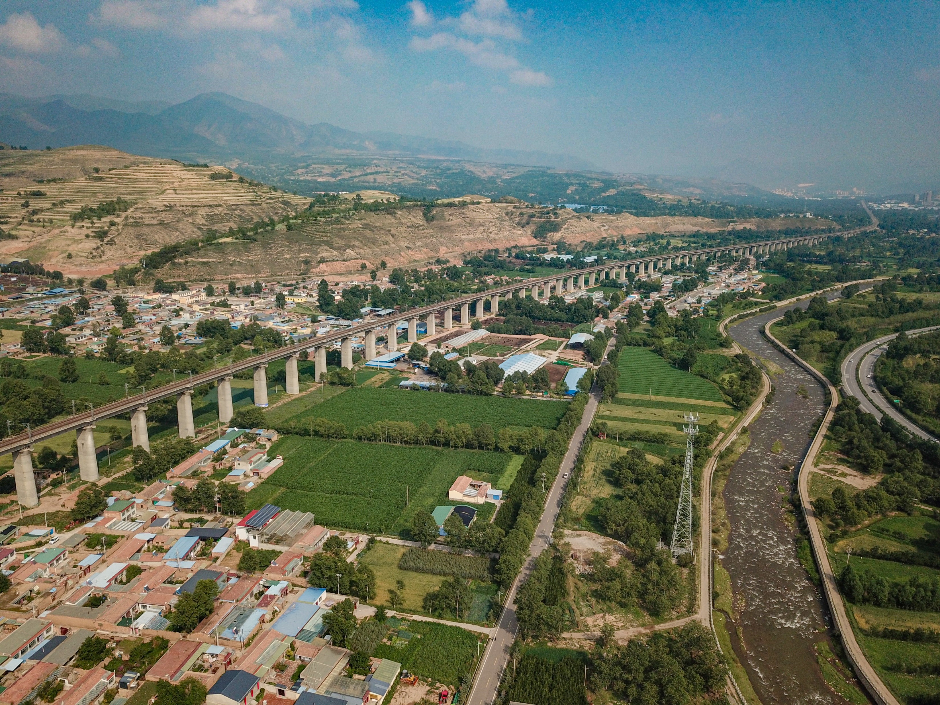
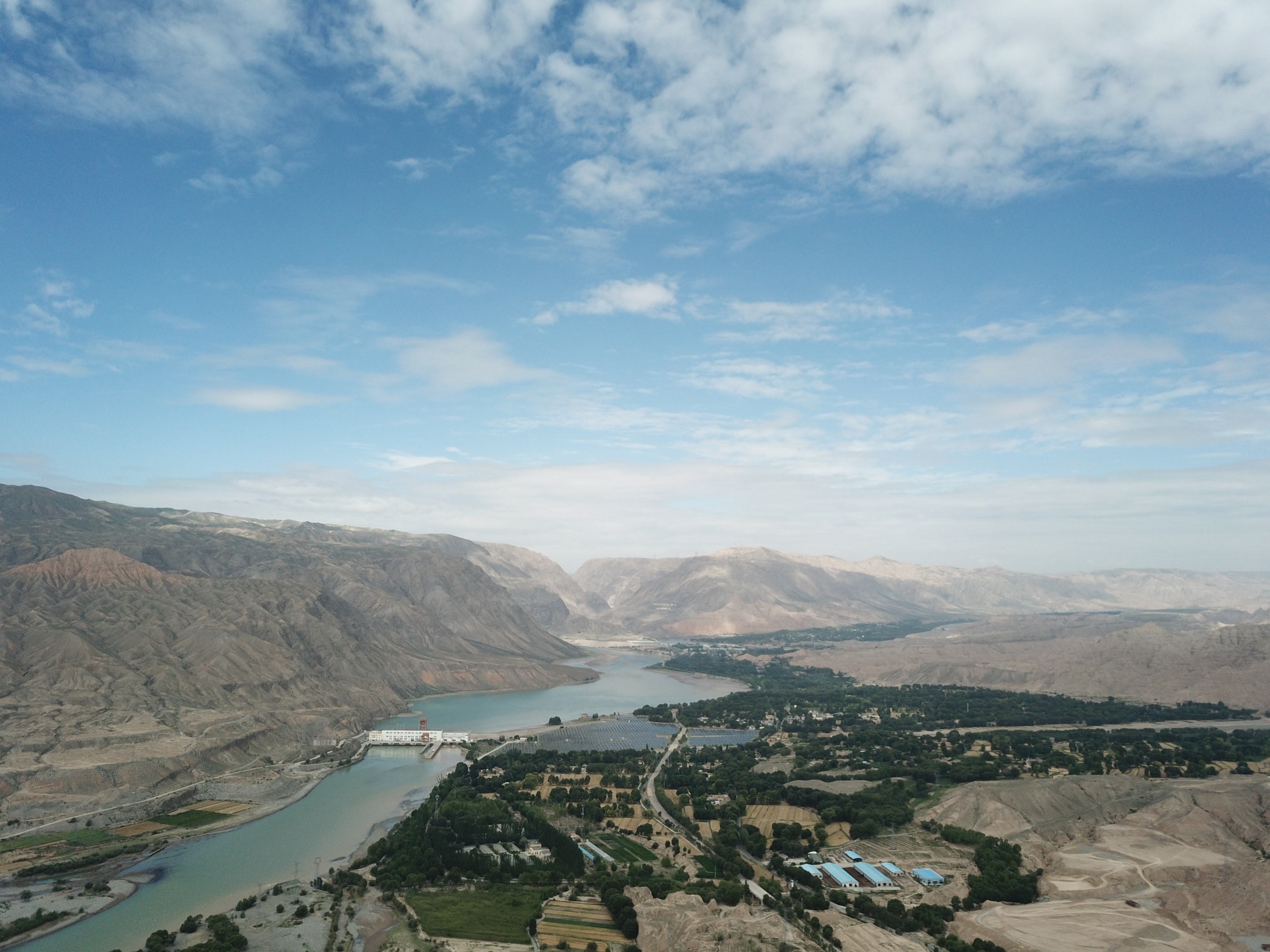
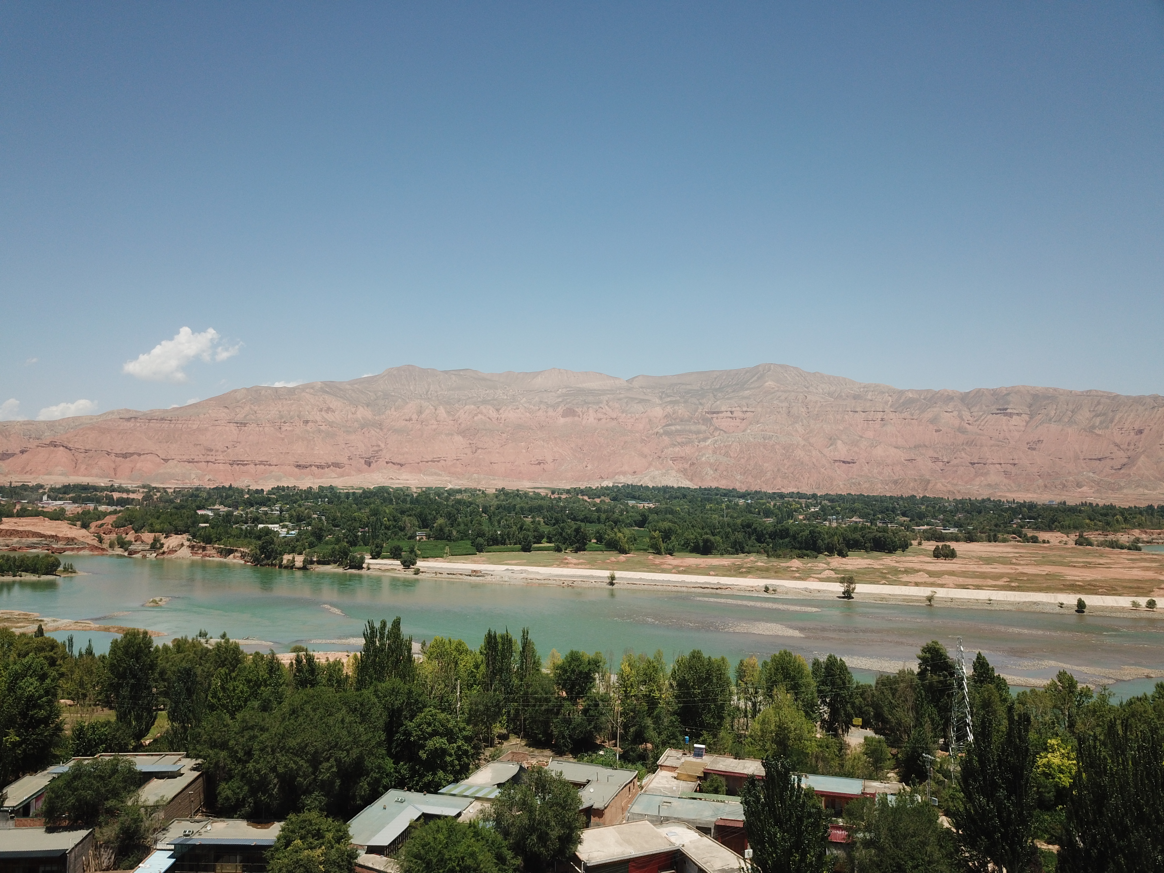
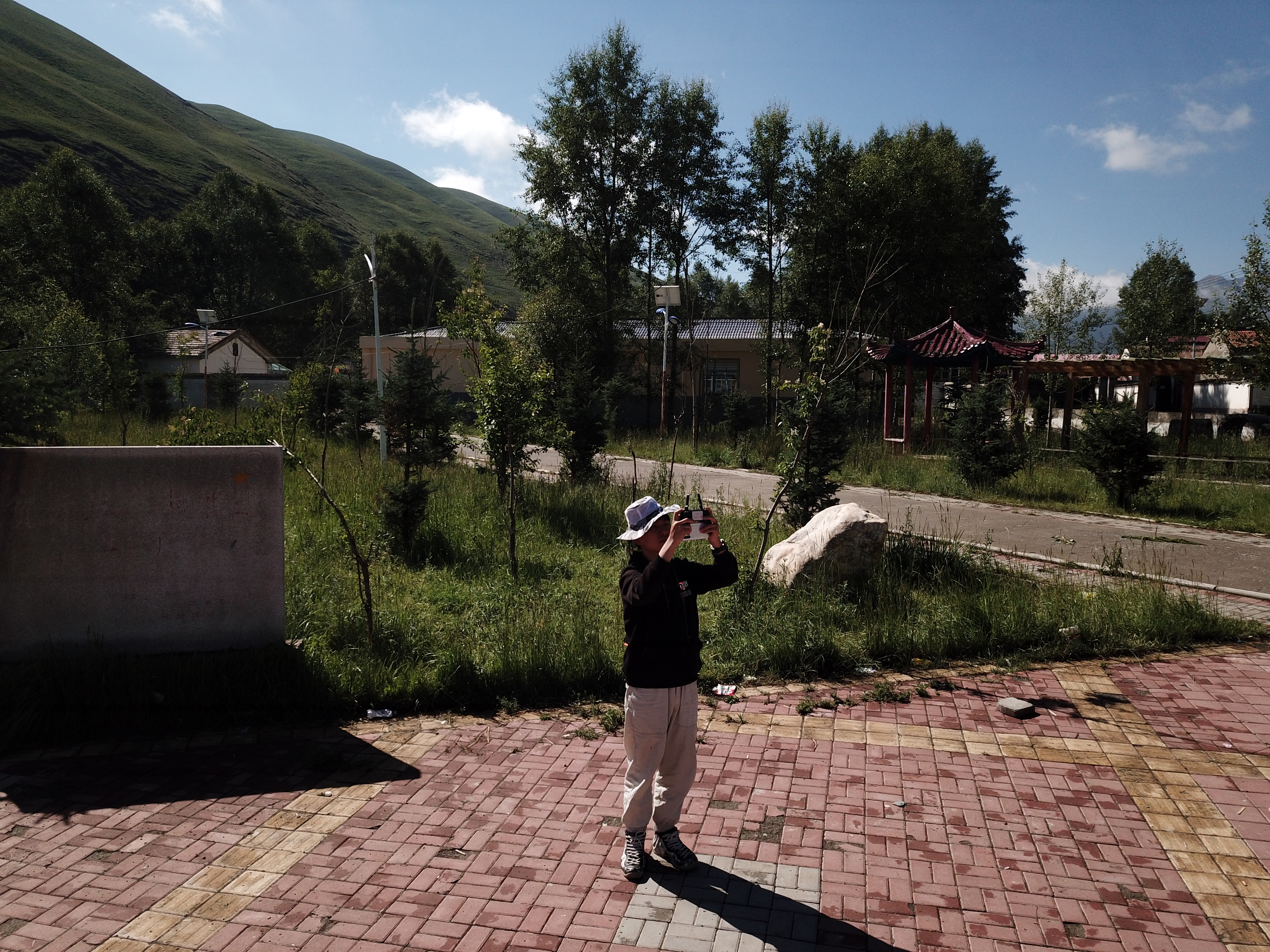
Photos taken by Xiaoyu during the 2022 Tibetan Plateau Scientific Expedition
Watch My VideoI earned my bachelor’s degree from Beijing Forestry University in 2025, with three first-author papers and two datasets, and a fourth paper under review. I have contributed to three national research projects, including the Second Tibetan Plateau Scientific Expedition and Research Program. During my undergraduate studies, I integrated multi-source remote sensing and spatiotemporal data to analyze vegetation dynamics, ecosystem health, UAV-based monitoring, land-use classification and prediction, and human habitat assessment. Additionally, I gained extensive fieldwork experience, such as a 38-day survey of 55 villages on the Tibetan Plateau in 2022. These works were reported by the China Media Group’s Asia-Africa Center and China Science Daily. Furthermore, these experiences built a strong foundation in remote sensing, ecology, and UAV applications. I am also proficient in Python, R, Google Earth Engine, and ArcGIS Pro for large-scale data processing and model training. Currently, as a research assistant at The Hong Kong University of Science and Technology (Guangzhou), I focus on urban carbon accounting through 3D land-use change and plan to apply large language models and deep learning algorithms to analyze urban remote sensing imagery and spatiotemporal big data.
I am interested in integrating multi-source remote sensing data with artificial intelligence to identify and address ecological and environmental challenges. My previous research has primarily focused on the following areas:
• Vegetation dynamics and ecosystem health
• UAV-based remote sensing for environmental monitoring
• Land-use/land-cover classification and predictive modeling
• Assessment of human settlement quality
Using satellite and UAV remote sensing data combined with objective statistical datasets, we constructed a multi-dimensional assessment framework for evaluating rural human settlement quality in the Tibetan Plateau. Validated by villager satisfaction surveys, this study demonstrates the feasibility and advantages of multi-source data approaches, providing a scientific foundation for settlement improvement and revitalization projects in high-altitude areas.
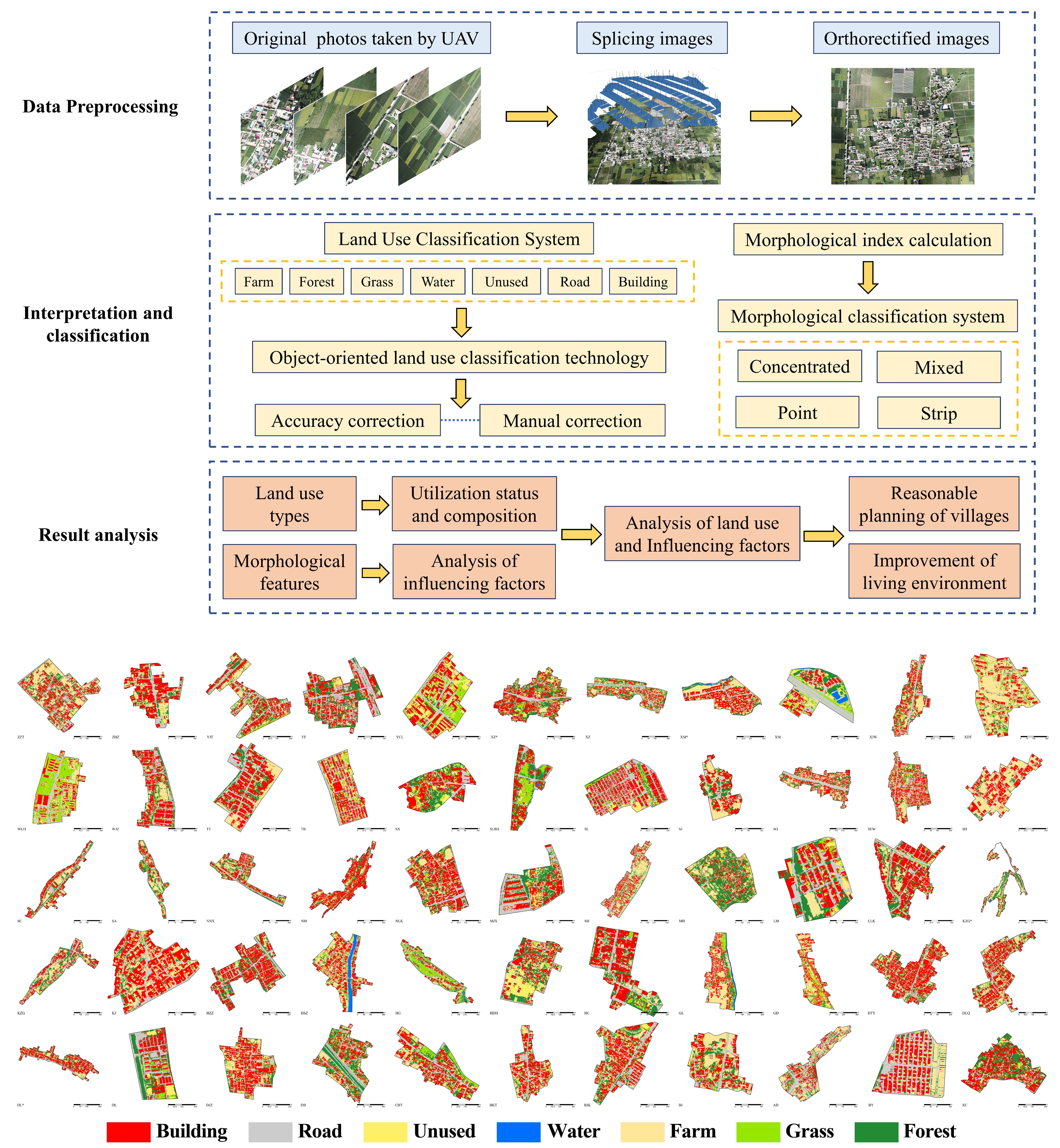
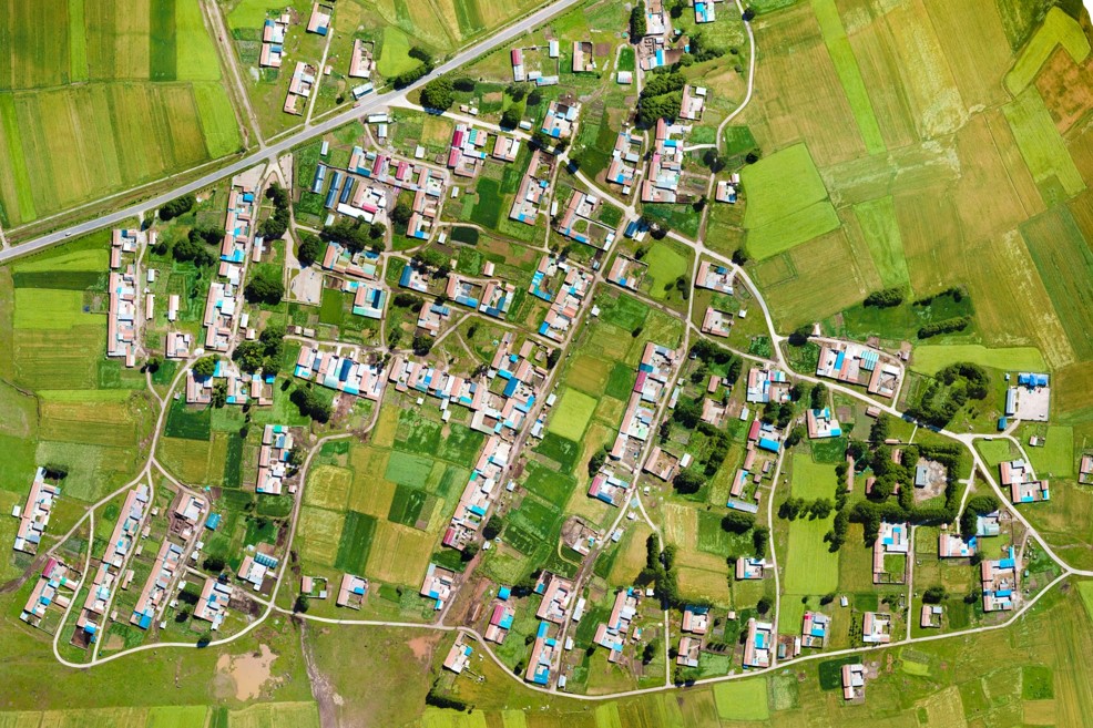
We employed object-based segmentation and machine learning algorithms to classify ultra-high-resolution UAV imagery collected from villages. This study provides unprecedented large-sample, high-accuracy land use data for villages in high-altitude regions. We analyzed the land use composition, influencing factors, and spatial patterns of these villages, offering valuable insights for land-use optimization and rural revitalization strategies. Additionally, based on this dataset, we assessed the extent and spatial distribution of village green spaces in 2022. Utilizing the GEE platform, we analyzed temporal trends in green land from the past 23 years and identified potential areas for improvement using multivariate regression models incorporating natural and socioeconomic factors. This represents the first comprehensive, village-scale green land study on the Tibetan Plateau, providing guidance for planning.
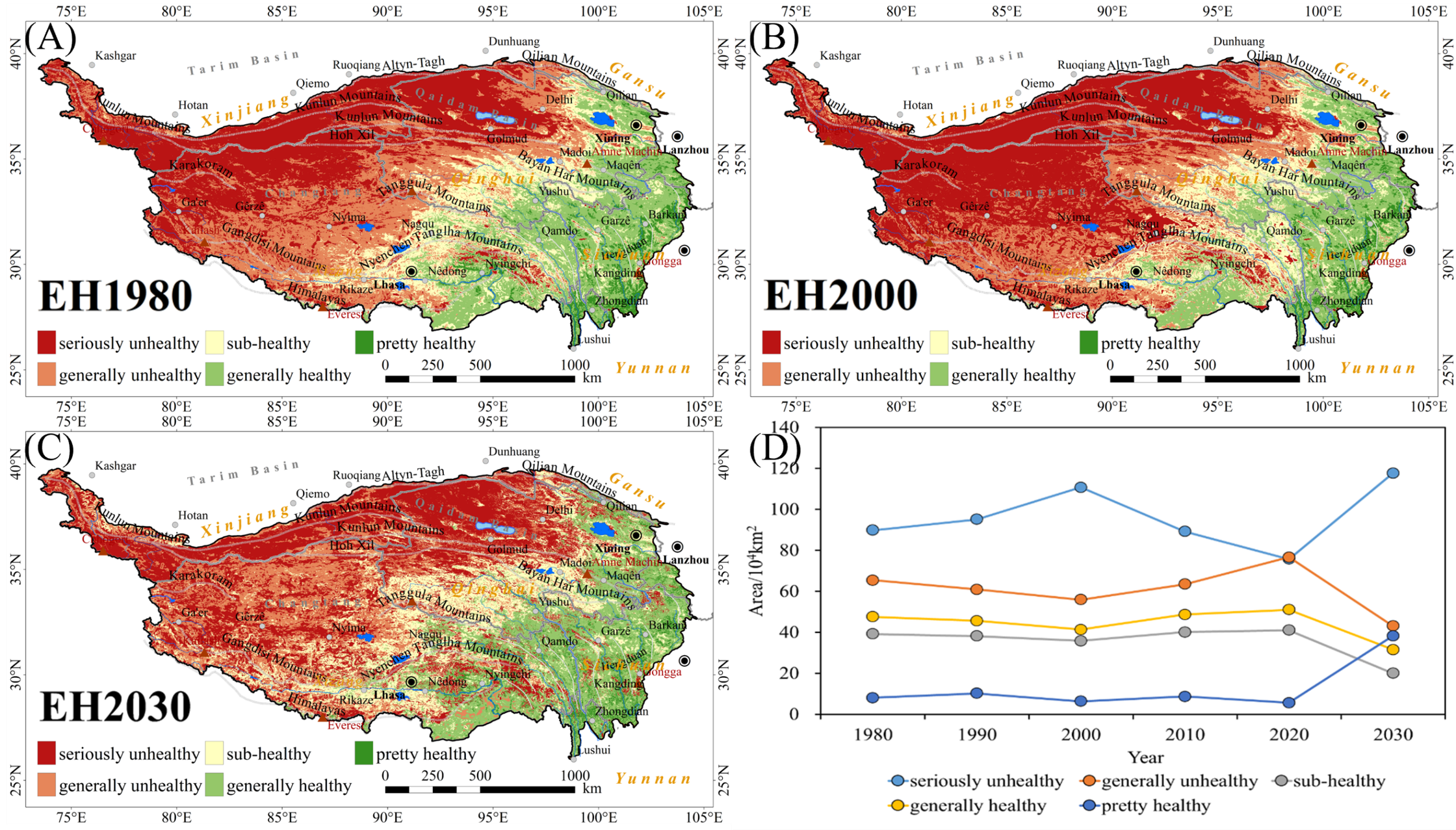
We used the Vigor-Organization-Resilience (VOR) model to assess ecosystem health changes on the Tibetan Plateau from 1980 to 2020. Based on CA-Markov model predictions of 2030 vegetation cover and land use, we forecast future ecosystem health trends. The results offer scientific support for ecological monitoring, land-use planning, and policy-making in the region.
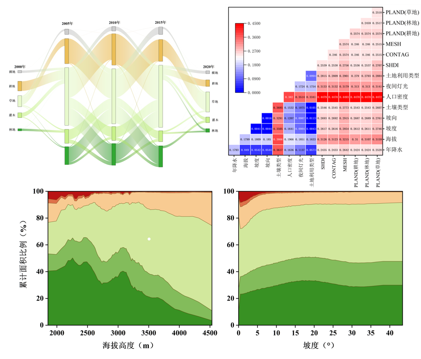
Based on the annual maximum MODIS NDVI data over past 20 years, combined with the Mann–Kendall trend test and partial correlation analysis, we examined the spatiotemporal changes in vegetation in the northeastern Tibetan Plateau. By selecting key natural and anthropogenic factors, the Geographical Detector was further used to identify the dominant drivers of vegetation change. This integrated approach addresses the limitations of relying on a single method or few factors, and provides scientific evidence to support ecological improvement in the region.